Friday, day 2 on Easter Island/Rapa Nui
After a nice breakfast of assorted cakes, cereal, bananas, pears, apples, avocado and scrambled eggs, we boarded our bus for Ahu Akahanga.
This is the site of one of the oldest villages on the island. Important people lived in such a center, close to the statue and the water. They lived in homes with stone bases and woven mats of reeds for walls and roofs. The town was a religious and astronomical center.
"Sticks" (probably bamboo like poles) were inserted in holes and then used to support the reed mats for the walls.
We all took shelter in a cave during a short rain and wind storm; It was much less noisy and very well protected from the elements.
 |
| Waiting out rain in cave. Others were better dressed for it than I was. |
From far away, we could see an ahu and several toppled statues, which have rested that way for several hundred years.
The above moai were early ones, made from basalt rock and were shorter, only 5 to 7 feet high. Later volcanic rock was used. It was lighter and still quite solid.
The skull of the first king along with the rest of his bones were buried here, but the skull was stolen by explorers and now resides in a museum in Europe, mapbe the Louvre according to Polo.
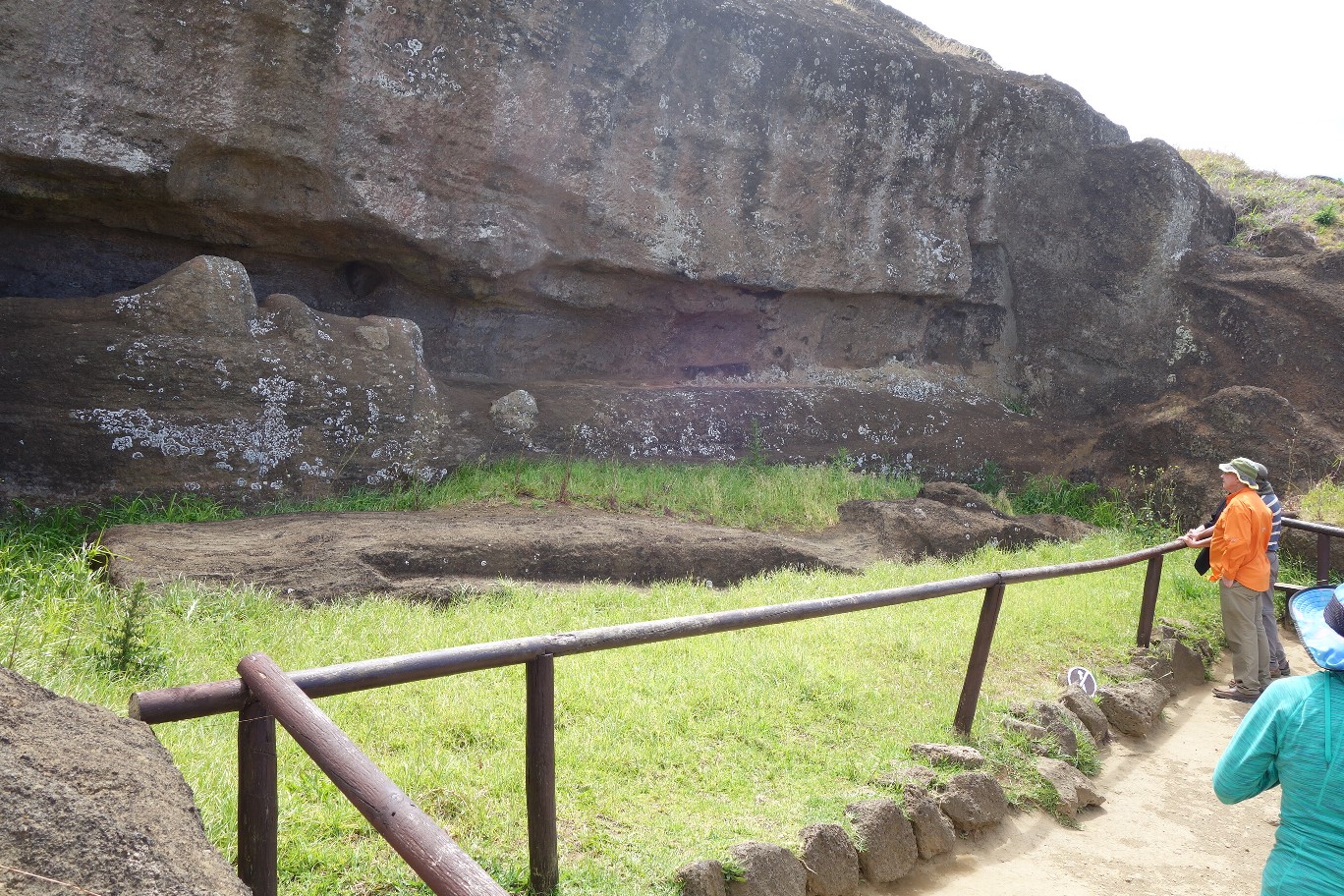
The following moai was fascinating. It was by itself and was different from the others. Usually the moais were totally carved except for the eye sockets. Those were left for the final ceremony when a family member of the deceased would carve out the eye sockets and put the eyes in. This statue was toppled or left to fall in an emergency before the moai would be placed on a platform, the bones put in the box below, and the ceremonial eye carving could take place.
Horses and cattle roam on the island and often cause damage to the moai. Below is a skeleton of a horse. The animal probably died from eating a poisonous plant like lupine.
The next site we saw was one of the most spectacular.
Ahu Tongariki is the longest platform on the island and with the most repositioned, colossal moai. They represent the height of the stone carving. It also is the largest ceremonial structure anywhere in Polynesia. The ahu is 220 meters or about 720 feet long. We were there in the morning when the sun's position was not conducive for taking pictures, but our bus driver stopped later on in the day so we could get better shots. Again, there is a row of stones marking the border as to where people can walk, so we could not get too close.
These statues were destroyed in the civil war in the 1700s. It was again damaged in about 1956 by a tzunami after an earthquake measuring 95 struct the Chilean coast. The platform at Tongariki was hit head on by colossal waves and some of the fallen moai were scattered and damaged.

A picture by explorers was taken of the ahu in 1886, with the statues facing the ground. Between 1992 and 1996, a team from the University of Chile restored the platform and the moai, using the 1886 picture to know where which moai to put in correct order. The platform is not the original but very similar. In the 1886 photo, 8 had top knots but now only one does.
 |
| Top know from behind |
It was a conscious decision to not put them up as they weighed between 8 and 10 tons each and were damaged, but some local people did put one up when the archaeologist was not present and it remains up today. These hats or top knows were made from scori and were from the quarry at Puno Pano. Unfortunately, I did not go there when the group went as I really was suffering from sinus issues.
 |
| The other top knots |
The Tongariki restoration project cost over US$2,000,000, and was paid for by the Japanese government and a private Japanese company, Tadano, which donated a crane to lift the statues, the largest of which weighed 88 tons. According to Grant-Peterkin, Japan has had an interest in Easter Island for quite a while, and a number of Japanese visit it.
 |
| Close up of 4 moai |
 |
| Close up of back of 2 moai |
The style of the moai did not change much over the years but the size definitely did. There were also designs on the back of some of them too.
In 1982, the moai that stands at the entrance to this site was sent to Japan by ship, where it was featured in Osaka and Tokyo at trade fares. It is now called the "travelling moai."
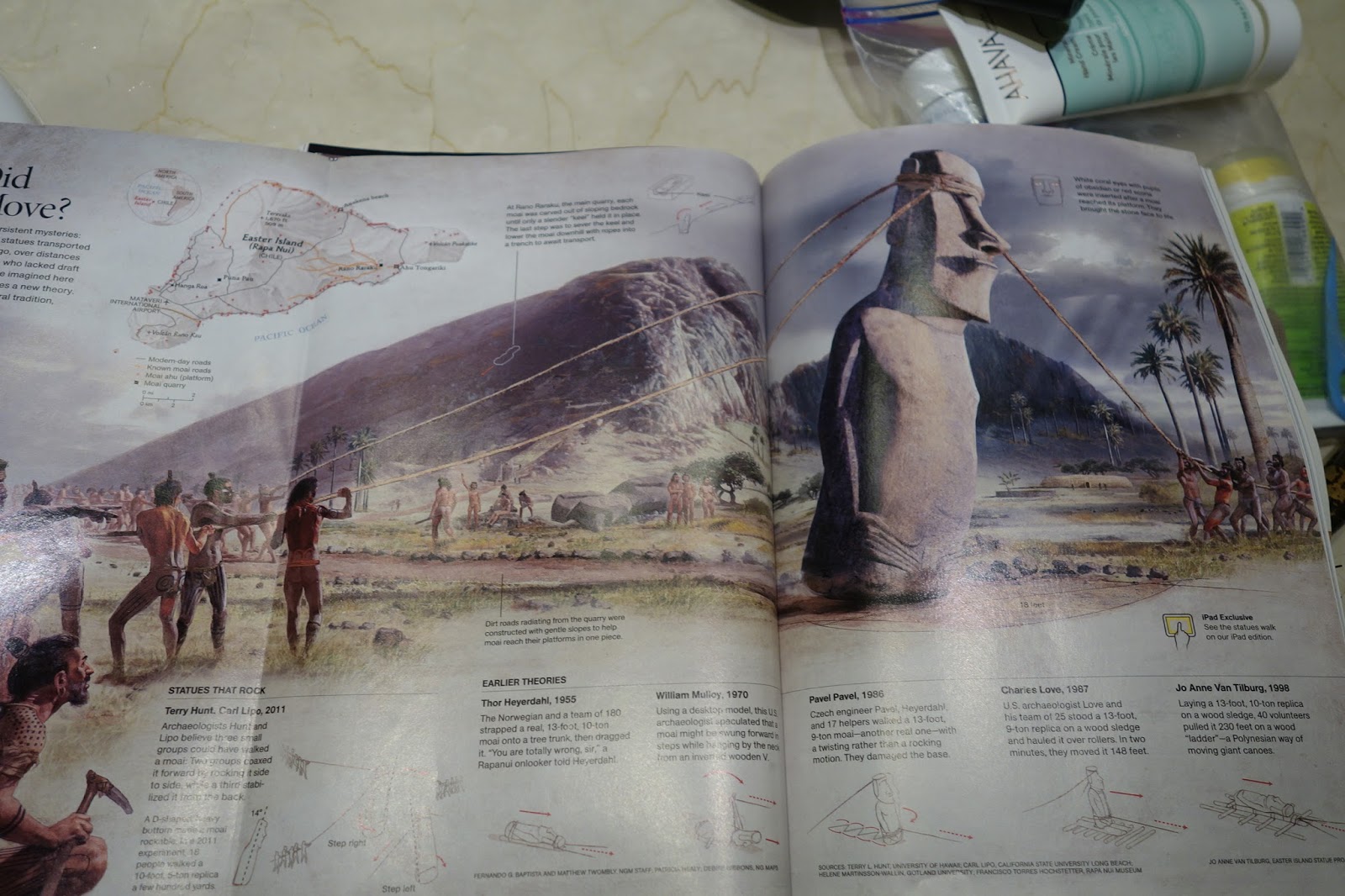
It is also one of 2 used by Thor Heyerdahl to test out his transporation theories. A model of it was also used by the National Geographic/Nova team to make the movie Mystery of Easter Island showing the most common theory of how the moai were moved. (It is what the oral tradition said--the moai "walked." Nava and I saw it before we went to Easter Island as I borrowed it from the Seattle Public Library.
A moai lying on its back never reached the platform. It either broke while being transported or while being transported the site was attacked in the civil war. The eyes were not carved out of it, so it is clear it never was used.
There are also petroglyphs at this site but I did not see them.
One reason that there were so many statues here is that the land belonged to the owners of the quarry, which was just 1 km. (.6 mi) from the site, in the hills in the picture above.
Our next stop was at the Volcano Rani Rakaru, the quarry where nearly all of the moai were carved and where over 600 unfinished moai still lie.
I thought the previous stop was amazing but this one topped it. Hundreds of moai are visible, partly buried or buried under sediment here, partially finished, after the site was abandoned in the 1700s..
At the entrance, there are several shops and the (obligatory) bathroom stop, with a minimal charge/donation to use it. There our guide showed us a fruit called "oropaui." I couldn't find anything about it on the internet with that spelling.
The stone is this quarry is called lapilli tuff, hardened volcanic ash. It is much softer and lighter than the basalt found throughout the island and used as carving tools. The softness of this tuff made it prone to weathering. (When I lived in Israel on Kibbutz Meron Golan, members of the kibbutz worked at a tuff quarry, and the stone their harvested was ground down and used for a layer under paved roads.
We first walked on a trail up the hill to the crater of this small extinct volcano. There were totora reeds in the water here too, like Lake Titikaka in Peru. The grass in the area was natural.
These familiar flowers were growing near the ground nearby. I've seen variants of them in Southern California and Israel.
At the entrance, there was this interesting pencil drawing of the various sizes of the moai over time as they got bigger and bigger.
We walked around a bit to get to the quarry itself.
 |
| Passed a small orchard, maybe of guava |
 |
| A broken, abandoned moai, a hint of what was to come |
 |
| Partially buried moai on the hill |
 |
| Only the head is showing of this moai |
 |
More and More moai, on their way down the hill and partially buried by sediment over time
|
Polo said that the carving began in the site. (A block was not first cut out and removed as I had first thought.) First the head was carved and all the details of the face but the eye sockets, then the body then the ears, and arms while the rock was still attached to the slope. Then it was separated from the slope with ropes and rocks with a pillar underneath, then sliced and pulled down off the hill on its back, and then raised up when at the bottom of the hill. Also at the bottom of the hill, the back was finished and flattened, often with symbols on the back to represent the life and rank of the person it was honoring. (Grant-Peterkin explained, "the back of the statue was carefully cut away from the bedrock in the form of a keep and then the released moai slid down the slope using a system of ropes and pulleys....the statue is then lowered into a prepared pit and stood upright so the carving on the back could be completed.")
We asked how such work could be done on such tall moai and Polo said that when the palm trees were cut for agriculture, the bases of the trees were used for scaffolds or stools to climb to carve the details of the head. As mentioned before the eye sockets were only carved when the moai were in place and were carved by members of the family of the important person represented.
In case you were dubious about some of the heads sticking out were actually attached to bodies, here is a photo that is in Grant-Peterkin's book (p. 81) showing a head moai that was dug out to show the depth it was buried.
Polo said that probably 6000 worked in the quarry as 600 statues were in the process of being made. At least ten worked on each statue. Each of the ten had a special job to do. The carvers were "paid" with food by the people/tribes ordering the statues, and were fed daily.
If the statues were 12 to 15 meters high (39 to 50 feet tall), it took 3 to 6 months to carve each. Each could weigh 400 tons, as they weighed 3 tons per cubic meter. (If they had been made with basalt, there would have been more than 3 times as heave, 10 tons per cubic meter.)
The site above was amazing. We could see a number of statues being carved on site. The three pictures below are from the same site.
 |
| In the center right above, you can see the tallest moai every begun, over 21 meters tall |
 |
| A straight on view of the tallest moai |
 |
| Three moai being carved on site, top, middle and bottom |
 |
| A view of the statues at Tongariki from above |
We saw one very unusual, kneeling statue at this site too.
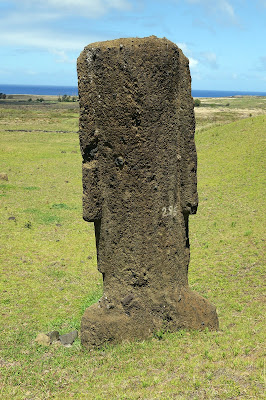 |
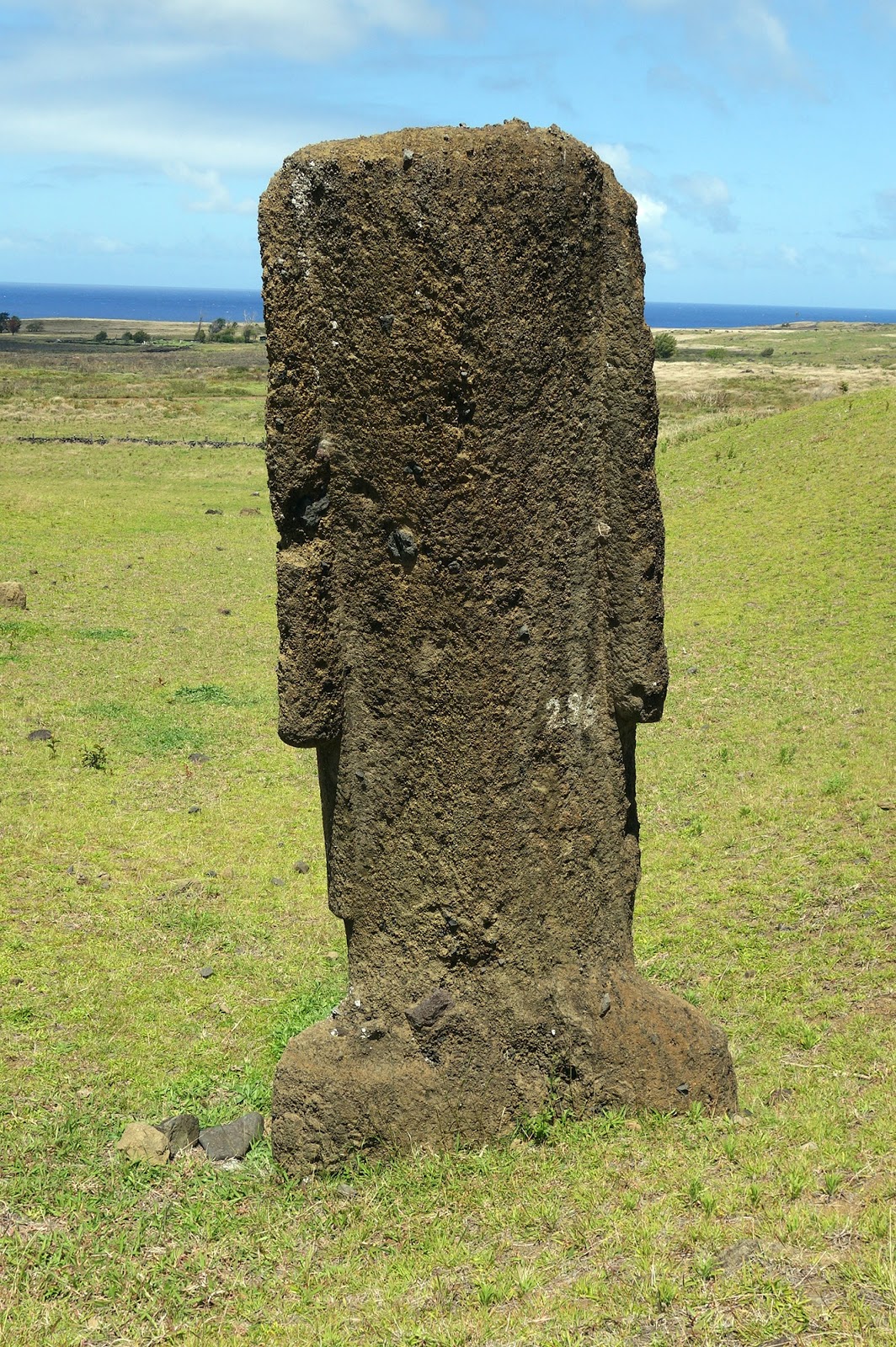
| Back of a mostly buried moai, notice the ears |
 |
Front of a partially buried moai, notice no eye
sockets carved out |
We then had an amazing chicken and rice lunch from the hotel, delivered to us at this site.
 |
| Here is where we ate lunch, under plastic models of reed roofs |
 |
| Nearby Tree |
 |
| Flowers on tree |
Several momma hens were nearby with chicks. This was the youngest group of chicks, just a day or two old.
We had to slow down for some horses crossing the road and enjoying a cool bath. BTW, most of the roads outside of town were unpaved.
Our next stop on this busy day was Te Pito Kura.
The only statue here, called Paro, is the beiggest moai ever moved and successfully erected at an ahu. It is 9.6 meters tall (30+ feet) without the hat and weighs around 80 tons. The top knot weighs about 12 tons, one of the largest every carved and moved. It was located far from the body. It was one of the last statues knocked down, some time after 1838 when it was seen standing by outsiders. Tradition says that it was ordered by a widow in memory of her husband.

The central stone below (around which four smaller stones were recently placed) is said by legent to have been brought by the island's first kind Hotu Matua from Hiva, the mythical island in Polynesia from which he had come. The stone was said to possess a lot of mana, the spiritual power bestowed by the gods and placed there by the king. The stone actually has a high concentration of magnetite. People have brought a compass over the stone, and it did not show correct directions, so the 4 stones were brought to mark the correct ones. (Grant-Peterkin said that it is similar to other large stones in the area and that it has a high iron content, meaning that it heats up more than surrounding rocks and can cause compasses to behave erratically. Oh well....)
The stone was moved from its original site. Some outsider tried to steal it but could not move it to the boat/ship as it was to heavy.
Our next stop was at Anakena and the beach.
 |
| a flower next to the area sign |
 |
| We are in the north center of the map |
Anakena was the sight where Hota Matua and his group of people in two double-hulled canoes landed over 1300 years ago, first colonizing this area. With the sheltered beach, one of just two on the island, it was a natural place to land. According to oral tradition, a priest in Hiva was possessed by a spirit who told him that there was another island to explore, so 7 people were sent by the king to go east and explore. Three stayed on what is now Easter Island; 3 went back and one died. Then the kind and his sister later moved to the island, with others, some chickens, and also rats. The rats may have been inadvertent or a possible food source. In any event, they eventually became one of the reasons (in addition to the land being cleared in part for agriculture) that the trees eventually disappeared as they ate the seeds.
It was to become the religious center for the royal Miru tribe. There were several restaurants around the area and several hardy souls from our group including our fearless leader Lu swam in the water and body surfed the waves. The water temperature ranges from 18 C in winter to 24 C in summer (64 to 76 F) and we were there in spring on a mostly overcast day.
There were originally three platforms here but only two are highlighted here. Again, the sun was not in the right position for a great shot. After the statues were toppled, sand gradually covered the entire platform, protecting the moai from the wind and harsh weather and protecting them from erosion. When one is close, it is possible to see the detailed carving of the faces and hands of these moai and even see the belly buttons of a few of them. The carvings on the backs of these statues are also quite detailed.
The other platform has just one moai, the first on the entire island to be re-erected. It was done in 1956 by Thor Heyerdahl with a team led by the mayor of the island. It took them 18 days to do so, using long poles to lever the moai up from the ground and placing stones underneath for support, in a way widely accepted at that time as historically accurate.
 |
| Me, Nava, and Lynn at the shore. Lynn later went in all the way |
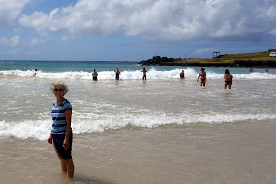 |
I did not have shorts or a bathing suit so wore a short skirt to the beach.
The water was cold but tolerable for wading! |
 |
| Haia, Les, and Nava--see! We did get our feet wet! |
 |
| Showing off our colored toenails on the beach! Guess which ones mine are!! |
After heading back to the hotel, we went to town for dinner. We all ended up at Kanahau, a restaurant that Lu had eaten at before. I don't think she realized that it had closed and was just reopening.
 |
| Sopapilla, served instead of bread |
Also, a group of musicians and dancers were practicing for their first performance of native-style dancing. After dinner, about half the group went to see a performance elsewhere. We heard it was quite nice. We got an introduction to it here.
 |
| Making intricate designs like Cat's Cradle with string while dancing |
Saturday: Day 3 on Easter Island
We again had a wonderful breakfast with fresh avocados and delicious scrambled eggs made and soft white cheese like in Israel.
We had the morning free, so Nava, Les and I took a cab into town about 1.5 miles (as I was having a sinus attack from all the wind and dust yesterday). We first stopped at the post office and bought stamps for 600 pesos (about 90 cents US) to mail the post cards we had written to our families/grandchildren and got our passports stamped with the symbol of Rapa Nui.
Then we walked to the local museum, Museo Antropologico P. Sebastian Englert. On the way we walked along the beach and saw more moai.
We also saw a beautiful children's playground and a great outdoor exercise area for adults, both built mostly from wood. We had fun a a teeter totter made from logs and on a climbing area.
 |
| Adult Play area--Haia and Nava. What a beautiful setting! |
Then we passed the local cemetery:
Before taking the wrong route and taking twice as long to go to the museum.
The museum is small but definitely worth the visit. It has great background information on how the island was created and good information and a map of migration to the area.
It also has carving tools used to make the moai and the only original moai eye every found (in 1978 during the restoration of Ahu Nau Nau).
All explanations are in English and Spanish including the one above that tells that the museum was named after the German missionary priest, Sebastian Englert, who collected many of the artifacts and contributed much to recording the island's culture. He came in 1935 to work as a missionary and soon learned the Rapa Nui language and began transcribing the ancient oral legends of the island. Just a small percentage of the 15,000+ artifacts are on display.
 |
| tools |
 |
| More tools |
 |
| Coral eye and broken eye socket and nose to which it was attached |
 |
| A smaller feminine figure |
 |
| Visual explanation of the creation of the island with verbal explanation below |
On the way back to town, we walked by Ahu Tahai. The three platforms here were restored by American archaeologist William Mulloy between 1968 and 1970. It has the only moai with a replica set of eyes.
We stopped by the Handicraft market inside the building below. There were some items also sold outside including some fruit and food.
 |
| We stopped at a local place and had vegetarian empanadas |
One of the others in our group had a National Geographic magazine with an article on how the Moai "walked." The picture below is a good depiction.

We went back to the hotel where I unfortunately had to rest for the late afternoon and early evening. The rest of the group headed to Ahu Vai Uri at Tahai. It is a single statue facing he winter solstice. The ancient people were very good with astronomy. It was situated on private land and not part of the national park and restored by William Malloy. Nearby there was a crematoria to burn the dead bodies and polish the bones and bury the bones of the elite in the drawer under the moai. Bones of the enemies were often used as tools.
The group also went to Puno Pao, the quarry of soft volcanic rock with a high iron content.
It was relatively easy to carve (and erode) and that is what gave it the red color. The Pukao or topknots were a later addition to the moais and there are only about 100 of them in existence compared to ten times that many moai. Top knots were not considered as hats (I've goofed) but representative of the hairstyle of the time, long hair tied up in a bun. In the ancient culture, it was forbidden (or tapu--the source of the English word "taboo") for certain high-ranking men to cut their hair.
Polo explained that the top knot may have been attached after the moai was "standing" and an indentation was probably carved on the head for the top knot to rest on.
The group then climbed a bit to get a good view of the town of Hanga Roa.
Next they went to Ahu Akivi, restored in 1960 by Mulloy and Gonzalo Figueroa. These seven figures face the ocean, unlike the rest of them. They represent the seven people arriving in the beginning from the island of Hiva. According to Grant-Peterkin, these moai both face the ocean and a village as their are remains of such a place between the moai and the ocean.
Although Mulloy was buried in Great Britain, his bones were brought back to Rapa Nui. Malloy's son settled on the island and married a local woman.

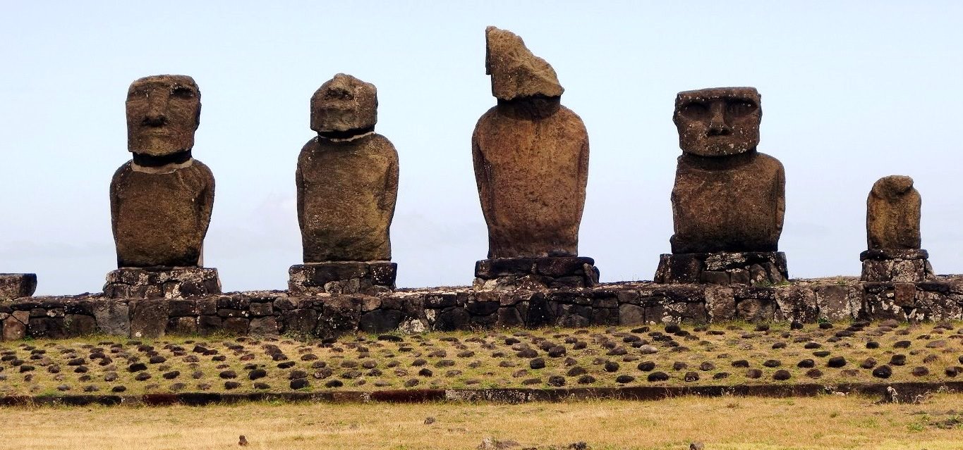
The group then went to another platform of 5 restored moais from different times to watch the sunset, with wine, crackers, chocolate and cheese.
The next morning after breakfast, a group of people walked to the church to see the traditional Catholic service with singing in Rapanui. The church was full and the priest was dressed in traditional clothing. I stayed back to rest and was beginning to recover from the allergy attack from the strong winds two days before. I left my lei on a statue in the lobby of the hotel and was told the replica statues were happy to receive it!
The visit to Easter Island was amazing and I am very glad I went, in spite of the long flights both coming and going. We headed out at 12;30 for the airport and a flight to Santiago where we would overnight and then fly to Buenos Aires the next morning on the next big leg of our adventure!!
Until now, I really had not touched on the life of the Rapanui people.
The island was given the name Easter Island in Dutch by Jacob Roggeveen when he explored the area in 1721, first sighting it on Easter. The Spanish named it San Carlos in 1770 in honor of the king of Spain. The name Rapa Nui is not the original name, and was only recorded in 1838. Oral history says the name of the island was Te Pito O Te Henua (The Navel of the World) but that too was only heard for the first time in 1873 and found it way into the ancient oral traditions, according to Grant-Peterkin. The name may simply have been Te Kainga (literally "the Land").
After Roggeveen's visit, no one else came for 50 years when Felipe Gonzalez de Haedo arrived from Peru in 1770 to claim the island for Spain. After a six day visit, they departed and didn't come back. Four years later, Captain Cook bought his sick crew into Hanga Roa, hoping for supplies and fresh water. He only came ashore briefly and found it in worse condition that the Spanish had reported 4 years earlier.
1862 brought a catastrophic change to the island when Peruvians came to get agriculture "workers" which the country desperately needed after having abolished slavery in the previous decade. Over 1500 Rapanui were forcibly removed and brought to Peru and only 15 were ever brought back to Rapa Nui. Unfortunately, they brought back smallpox with them and the local population decreased even more so by 1877, only 111 people lived on the island, most living in dire circumstances.
Soon after the slave raiders came, a Christian missionary came to the region and told his superiors that the inhabitants were on the brink of extinction. A permanent Catholic Mission was established in 1866, and it put an end to many of the ancient beliefs and the end of the Birdman Competition.
In 1888, Chile annexed Easter Island. A "Deed of Cession" was given to the person the missionary said was the island's king. In Spanish it said that Chile got "full and entire sovereignty" over the island indefinitely. The same document in Rapa Nui only offered "protection" and "friendship." Locals today still bristle over this exchange.
A sheep farming company, Williamson, Balfour and Co. acquired the island on a 25 year lease and set up a company to run the entire island as a sheep ranch with up to 70,000 sheep roaming the island. The islanders were herded from their ancient lands to Hanga Roa and fenced in, to prevent them from stealing sheep. Stone walls were erected over the island, often taken from the ceremonial platforms. Despite several uprisings by the natives, the lease was extended until 1936. The financial downturn caused by World War II spelled the end of the wool trade on the island.
The lease was finally revoked in 1953 and the Chilean Navy took over control of the island. Its run did not improve the living conditions of the Rapanui. It prohibited the local language in favor of Spanish. The Rapanui who traveled to Chile to do military service returned "wiser" to the ways of the world and a strong autonomous movement began. By 1965, Chile allowed the islanders to elect their own mayor, and finally they were given full Chilean citizenship in 1966. Since then the islanders have gotten benefits not found elsewhere in the country including no income tax, subsidized fuel and air travel, free schooling and health care, and, most importantly, that the land can only be owned by the Rapanui. In 2007, one local leased his land to a hotel group for 20 years, so that has changed the situation. There are now about 3,000 people of Rapanui descent, a huge growth from the 111 that were left 120+ years ago. The local people are very proud of their heritage, the slower pace of life on the island, and the natural beauty of the place.
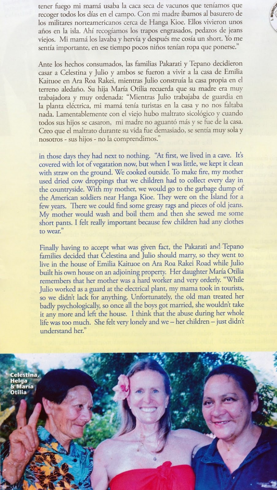
On the airplane, we were given a copy of the October 2015 issue of Moe Varua, a magazine about Rapa Nui, and it had a story of a an 81 year old woman named Celestina Hotu Pakarati and the horrid conditions in which she grew up and raised her family, living in caves in extreme poverty. Life was extremely difficult.
In 1995, the Rapa Nui National Park, which makes up over 40% of the island, was declared a UNESCO World Heritage Site, so it was able to get greater financial and conservation resources.
95% of the island's population lives in Hanga Roa, which is the only place on the island with electricity and running water. The standard of living for locals has greatly increased with the increase in tourism.