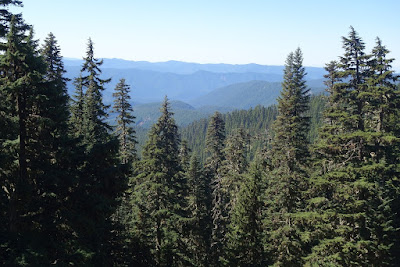
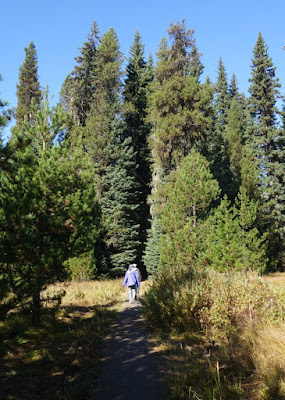
We spent our 5th day in the area on Mt. Hood, a 30 minute drive up a great road to the Timberline Lodge and ski area where we also watched the eclipse. We had hoped to get the 11 a.m. tour of the lodge, but tours were cancelled this day as the staff was elsewhere. We decided to take the trail that joined the Pacific Crest trail. It ended up being about 5 miles RT. There was a gentle climb, which was not strenuous, through meadows and forested areas. There was several places where the path narrowed and there were drop offs right off the path.
Mount Hood Wilderness Map
The Mont Hood Wilderness is not the same as the Mt. Hood National Forest area.
Timberline Lodge is due south of Mt. Hood in the picture above. We took the trail heading to the left, above the lodge.
At the beginning of the trail, we passed two of the chair lifts to the ski area. A young woman named Irina from St. Petersburg, Russia joined us on the trail.
As we walked along, we had different views. Sometimes to the left we could see Mt. Jefferson and the Three Sisters and also Trillium Lake.
To the right we could see Mt. Hood.
We didn't see many animals, just some birds (mainly grey jays) and chipmunks or ground squirrels.
A grey jay
Tall Trees
The view south three the trees
A dead tree amung the living ones
Trees living and dead
Rocks in a wadi heading south
Rocky meadow
We got to a special view point where we could see both to the south and the north.
I had to scrunch down low to get a picture of the river coming down from the mountain and the mountain peak itself.
Usually the mountain gets 600 inches of snow a year, but this year it got less than 1/4 that total. They did have some skiing into July for experts. In the past, the mountain was covered by snow year round with skiing also year round. Hopefully, more snow will fall this coming year but the prediction is for a warmer and drier winter. We do need the rain in the Pacific Northwest.
After the walk, we spent time seeing more of the lodge.
The lodge was built in 15 months in the mid-1930s during the Great Depression with workers employed by the government. The building is on the National Historic Register. You can read about the history of the building at:
https://en.wikipedia.org/wiki/Timberline_Lodge
The front of the lodge.
Weather vane in shape of snow goose, the symbol of the lodge
Art on front door.
Art hanging near fireplace
Lobby: chairs made from animal hides--not very comfortable for sitting though!
There is quite a lot of art in the lodge.
Animal mosaic around a water fountain
Wood carving on wall
Quilt of Mt. Hood
Painting by Sewall
Carving on staircase by railings
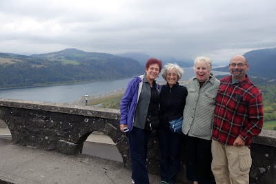
The four adventurers!
The next day, day 6, we drove 40 minutes to get to Little Crater Lake. It is a tiny lake, but is super clear and one can see to the bottom of the 45' deep lake.
It was amazing! We first walked less than 1/3 mile, through a meadow and then a forest to get to the lake.
See the trees that had fallen into the lake.
We continued walking 1/4 mile and got to a sign directing us to another segment of the Pacific Crest Trail and the path to Timothy Lake, another artificial lake, made by the local power company when a dam for hydroelectric power was constructed. BTW, it was 1/2 mile to the trail, not the lake!
a natural cedar sculpture
A dead tree across a creek
a boardwalk over a dry area that once had been swampy
Mushrooms along the path--it is that time of year
We started near the top and walked down the right side. The square half way down the right side is where we stopped to eat our lunch. MM and I stayed to rest and enjoy the sounds, while N and MS walked down a bit father to see the whole lake. I was tired this day--maybe after yesterday's 5 mile hike at an altitude of 6,000 feet. If people walk to the southern point and it is a clear day, they can see the mountain.
Our first view of the narrow top part of Timothy Lake
Lunch on the lake shore
Trunks left from before the lake was created by the power company
Single flower growing out of a tree trunk on the shore of the lake
Birds (ducks?) on the water
Amazing change of color in the water as the lake narrows
Deciduous conifer (Larch--thanks Lynn) changing colors in fall
Lone flower growing on the ground
Beautiful signs of fall
Day 7, our last full day in the Mt. Hood area, we headed to two falls near each other, Umbrella and Sahalie Falls. We found out while doing our research that there are two Sahalie Falls in Oregon, the other west of Bend. When we stopped at the Zig Zag Ranger Station, we got additional maps and were told that the trail for Sahalie Falls was not well marked. Boy, was that an understatement!!! The route to the falls was a loop. There was an easier way (to the left) and a harder way (to the right). It was suggested that we take the left loop and return the same way we came for an less challenging walk. We found the following sign:
Unfortunately, it was for the right loop, and we had no idea that the left entrance was less than a block away.
However, if we had not taken the right loop with its steeper trail, we would not have seen the beautiful colors of fall along the way.
Close up of colorful vine maple
Unusually shaped dead tree trunk
N among the fall colors
Umbrella Falls
After this more difficult hike, MM chose to wait at a nearby entry to a road where we would pick her up, and N, MS and I went back to finish the loop. There may have been a turnoff to the Sahalie Falls, but it was unmarked. We also only met 2 or 3 couples along the trail, the fewest we had seen all week. It took us about an hour to walk back and definitely was a much easier trail to use as the slope was much more gradual. It was not as picturesque as the more difficult trail had been.
When we got to the exit, we saw that the trailhead was not marked. We were not sure where we were but after a wrong turn, we found the car, only about 2 blocks from our exit from the trail!
As we drove out to pick up MM, we passed Sahalie Falls from the road. We agreed to go back after getting her. Unfortunately, it was not easy to get back as the road was one way. After 3 attempts, we finally made it on the 4th and were rewarded with this view.
Sahalie Falls
There were not a lot of somewhat healthy choices for meals. MM coordinated three meals in our unit. We had our best meal at the Rendezvous Grill, including locally picked chanterelle mushrooms. We got food twice at Wraptitude and discovered that the wraps were great but not the burgers. This final night we ate at a local Mexican restaurant, El Burro Loco, that was highly rated on Trip Advisor. They did have some healthier options and had vegetarian beans for those who did not want the ones with bacon fat and had delightful servers, but it still was a heavier but tasty meal.
The next morning, we checked out by 10:30 and headed north to one final place that MS remembered, Vista House. It was a treasure.
Vista House is an observatory on a 733 feet (223 meters) cliff above the Columbia River, close to many waterfalls, that originally served as a "comfort station" for travelers on the Historic Columbia River Highway. It opened in 1918, and many people thought it was a very expensive "outhouse," built in a German Art Neuveau style. It is a domed rotunda, 44 feet (13m) in diameter, octagonal-shaped with a 64" (20 m) diameter, with a main floor, basement, and an outdoor balcony viewpoint on the 2nd level.
It was closed in 2000 for 5 years to refurbish it to its original style and make the bottom floor more functional.
It was placed on the National Historic Register in 1974 and is owned by the state of Oregon.
The views were stunning even though we were there on a very cloudy day, and the building amazing with stain glass windows and marble floors.
Inside dome
Close up of a window
Marble floor
Vista House is above many of the falls along the Columbia River.
This was a stunning end to a wonderful 8-day trip to the Mt. Hood area of Oregon. There was so much more there than I had anticipated and it was a delight. And we travel companions got along very well.


